Info:
Title: MEASURE - Code: 45746Contest: Rio de Janeiro / 2013
By: Alfie Koetter - Emmett Zeifman
Views: 5163 Likes: 4
Votes:
Alejandro Zaera-Polo 8 Jeffrey Inaba 9 Jeroen Koolhaas 7 Hernan Diaz Alonso 1 Cristiano Toraldo di Francia 8 Pedro Rivera 97.0
MEASURE
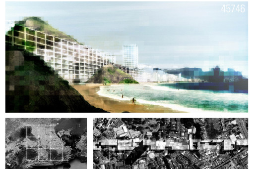
“The work establishes a measure: one’s relation to it and to the land.” Richard Serra on Shift (1970-72) Rio de Janeiro is determined by topography. The landscape dictates the urban form. Even Le Corbusier succumbed to its curves. The patchwork textures of the city compress and expand to fill the spaces between water and mountain. They dissolve into something else entirely as they spread up the sides of the hills, changing state with the change in altitude. City becomes favela. Rio de Janeiro is divided by topography. Development bends to the will of gravity. The resources of the city pool in the lows, while the highs are fragments of another form of urbanism, segregated and underserved. There is no grid in Rio de Janeiro. There is no universal structure that offers correspondingly universal access to areas of urban inhabitation. There is no plan for the distribution of population, property, or services. There is no definitive limit–no straight edge–against which to test topographical shifts and their socio-economic correlatives. We imagine this grid. Orthogonal lines run across the landscape of the city. They cut through the hills. They are both built fabric and open space. They bridge and divide. The nine squares of the grid define a new structure for the city, enclosing diverse neighbourhoods and topographies and transforming relationships between parts. The grid connects north to south, east to west, hill to beach. It passes indiscriminately through physical and social strata. It reveals proximities. It draws distinctions. It breaks boundaries. This grid is a ghost. It is a figure latent in the image and form of the colonial city. These straight lines are a complement to the curves of Rio de Janeiro, another city lying within the one that has been built. The imprint of this grid on the topography of the city suggests new ways of seeing the existing city, new ways of understanding the conditions of its inhabitation. We bring it to the surface as a measure of the city. It is a measure of form, of inequality, of possibility.


